The Ascent: A Multi-Day Mauna Loa Adventure
Journey to the summit of Earth's largest volcano on a challenging 4-day expedition

Written by a Local Expert
Leilani AkoReaching Mauna Loa's Summit: Serious Business
Reaching Mauna Loa's summit is serious business. This isn't a casual day hike. It demands excellent fitness, careful planning, and deep respect. The reward is standing atop one of Earth's most impressive mountains.
With the main trail closed, the ʻĀinapō Trail is your best option for a summit attempt. This historic route climbs from the south side of the mountain. Ancient Hawaiians used parts of this trail. It connects the coast to the high alpine areas.
The ʻĀinapō Trail: Your Path to the Top
The trail is challenging and remote. You'll need permits from two different agencies. The State of Hawaii controls the lower section and Halewai cabin. Hawaii Volcanoes National Park manages the summit area and upper cabin.
Getting to the trailhead requires a 4WD vehicle. You'll drive through Kapāpala Ranch on private roads. You need a gate code from the state. This adds another layer of planning.
📏 Trail Distance
19.5 miles round trip from ʻĀinapō Trailhead to summit with 7,927 feet of elevation gain
⏱️ Duration
4 days, 3 nights minimum. Day 1: Halewai Cabin. Day 2: Summit Cabin. Day 3: Explore. Day 4: Descent.
🏔️ Elevation Profile
Start: 5,750 ft → Halewai: 7,750 ft → Summit: 13,677 ft. Extreme altitude change requires acclimatization.
💪 Difficulty Level
Very challenging. Requires excellent fitness, high-altitude experience, and mountaineering skills.
Four Days and Three Nights on the Mountain
Day 1: Getting Used to the Altitude
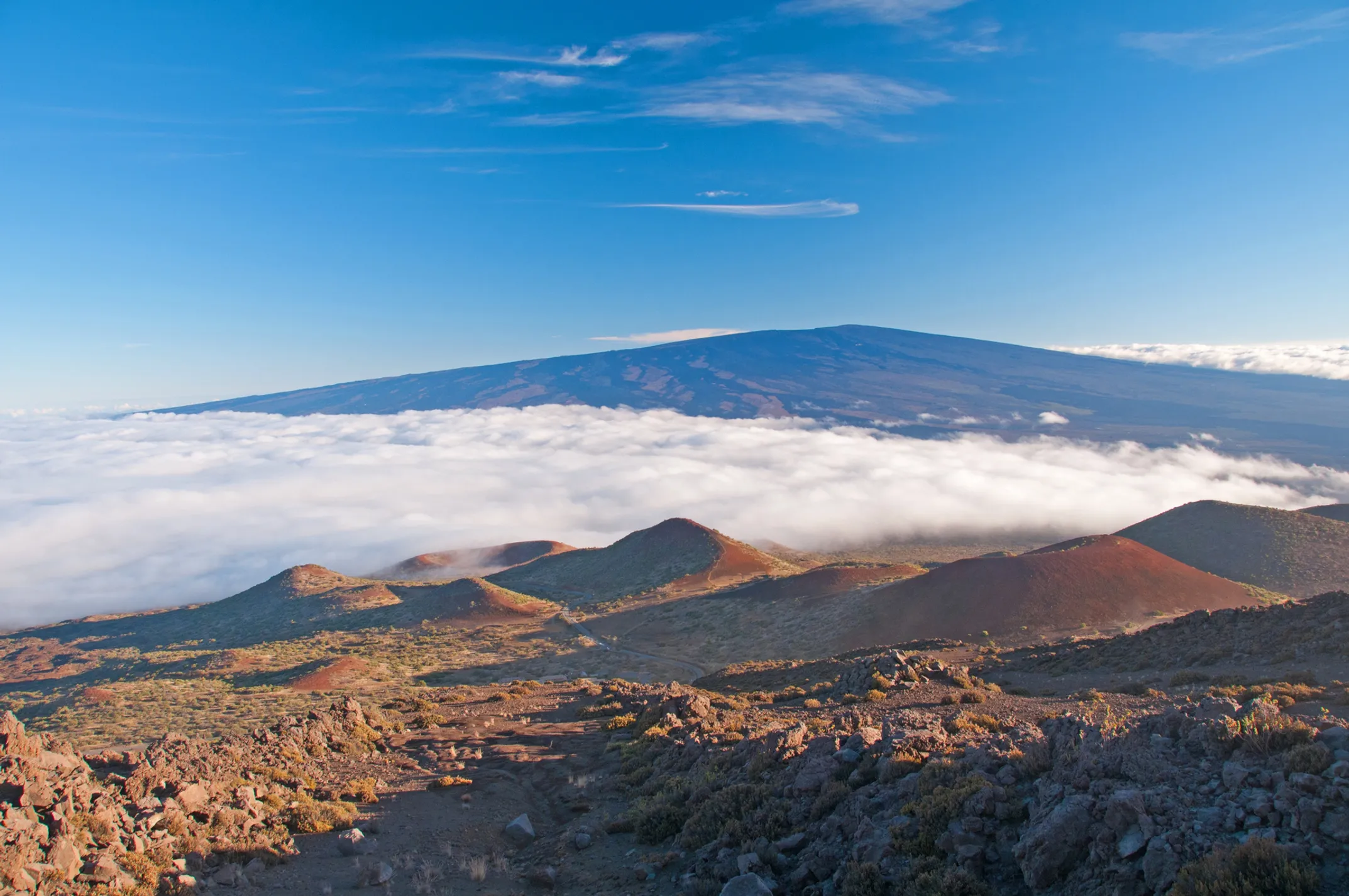
Start early from the ʻĀinapō Trailhead. The first 2.7 miles climb 2,100 feet to Halewai cabin at 7,750 feet. This day is about getting used to the thin air. Drink lots of water. Take your time.
The trail passes through sparse forest. You'll see native plants like ʻōhiʻa trees and ferns. The higher you go, the more open it becomes. Halewai cabin is basic but solid. It has bunks and a pit toilet. Water comes from roof catchment and must be filtered.
Day 2: The Big Push
This is the hardest day. You'll climb 7.5 miles and gain over 5,500 feet. The trail crosses rough lava fields. Every step requires attention. The landscape becomes more alien as you climb.
Around 10,000 feet, trees disappear. You enter an alpine desert. The air gets thin. Many people feel the altitude here. Headaches and nausea are common. The key is going slow and staying hydrated. The Mauna Loa Summit Cabin sits at 13,250 feet on the rim of Mokuʻāweoweo crater.
Day 3: The Summit and Crater
Today you explore the summit area. First, head to the true summit at 13,677 feet. It's marked by a survey benchmark. The views stretch across all of Hawaii and beyond.
Then spend time exploring Mokuʻāweoweo crater. This massive bowl is over 3 miles long and 1.5 miles wide. It's 600 feet deep in places. The 2022 eruption started here. You can still see fresh lava flows. The scale is hard to grasp. The crater could hold a small city.
Day 4: The Long Way Down
Going down is hard on knees and ankles. The loose lava rock makes every step tricky. Take your time. Many injuries happen on the descent.
The trail seems to go on forever. Your legs will be tired. Your feet might hurt. But gradually, vegetation returns. Trees appear. The air gets thicker. Finally, you reach the trailhead, tired but accomplished.
Alternative Routes
The Observatory Trail
If you're short on time or permits, consider the Observatory Trail. It starts from the Mauna Loa Observatory at 11,150 feet. This makes it a very high-altitude day hike.
The trail is 3.8 miles to the crater rim. It gains about 2,500 feet. The Observatory Road requires 4WD. Check if it's open. The 2022 eruption damaged parts of the road.
North Pit Trail
This short trail connects different parts of the trail system. It leads to North Pit, a smaller crater on Mauna Loa's flank.
The trail is about 2.4 miles round trip from the observatory. Good for acclimatization or when the main summit is closed.
🚨 Trail Status
- Main Trail: CLOSED
- ʻĀinapō Trail: OPEN
- Observatory: CHECK
- Last Updated: Check USGS
📋 Required Permits
- Hawaii DLNR (Lower trail)
- Hawaii Volcanoes NP (Summit)
- Kapāpala Ranch gate code
- 4WD vehicle required
🏠 Mountain Cabins
8 bunks, 7,750 ft elevation
12 bunks, 13,250 ft elevation
Pit toilets, rainwater catchment