The Rugged Coast: Māhāʻulepū Heritage Trail
Sacred cliffs, ancient sites, and the wild soul of the South Shore

Written by a Kauai Local Expert
Kalani MillerThe Rugged Coast: A Complete Journey on the Māhāʻulepū Heritage Trail
If Poʻipū is the polished face and Kōloa is the historic heart, then the Māhāʻulepū Heritage Trail is the wild, untamed soul of the South Shore. This is the last remaining stretch of undeveloped coastline in the region, a sacred landscape of dramatic cliffs, secluded beaches, and ancient history. It's a place that reminds us of what Kauai once was, and what we must strive to protect.
It is incredibly important to remember that this trail crosses private land owned by Grove Farm, which is graciously kept open for the public to enjoy. This is a privilege, not a right. When you walk this trail, you are a guest. Please practice mālama ʻāina—care for the land—by staying on the marked path, packing out everything you bring in, and treating the sacred sites with the utmost respect.
Trail Overview: A Window into Ancient Kauai
The Māhāʻulepū Heritage Trail offers something unique in modern Hawaii—a chance to experience the coastline much as ancient Hawaiians did. This 4-mile round-trip journey takes you through landscapes that have remained virtually unchanged for centuries. Here, you can understand how Hawaiians lived in harmony with dramatic natural forces, finding resources and spiritual connection in one of the most rugged environments in the islands.
The trail showcases geological processes that have shaped Kauai for millions of years. You'll walk on lithified sand dunes that formed during ice ages when sea levels were much lower. These golden cliffs tell the story of ancient beaches, now elevated high above the current shoreline by volcanic uplift and geological time.
Wildlife along the trail is spectacular. Seabirds nest in the cliffs, including the native ʻiwa (frigatebird) and koaʻe kea (white-tailed tropicbird). Hawaiian monk seals occasionally haul out on secluded beaches to rest. During winter months, the elevated vantage points provide excellent whale watching as humpback whales pass close to shore during their annual migration.
Access & Parking
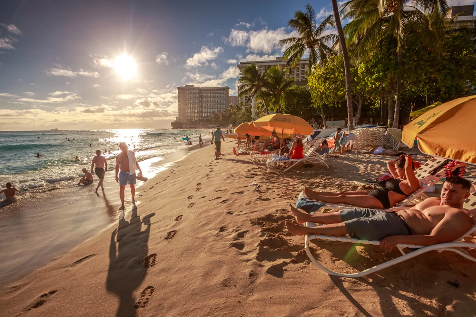
The trail officially begins at the eastern end of Shipwreck Beach, near the Grand Hyatt. There is a small, paved public parking lot at the end of Ainako Street, but it serves both hikers and beachgoers and fills up very quickly, especially on weekends.
If it's full, you can often find parking in a dirt area or along the street near the Poʻipū Bay Golf Course. The only public restrooms are located at this parking lot, so plan accordingly. Arriving early, particularly on weekends and holidays, significantly improves your chances of finding convenient parking.
The trailhead isn't immediately obvious from the parking area. Look for a small wooden sign near the eastern end of the beach that marks the beginning of the heritage trail. The path initially heads inland through a grove of ironwood trees before climbing toward the cliffs.
ℹ️ Trail Info
- Distance: 4 miles round-trip
- Difficulty: Easy to Moderate
- Time: 2-4 hours
- Shade: Very little
- Dogs: Leashed OK
🎒 What to Bring
- Ample water
- Reef-safe sunscreen
- Hat & sunglasses
- Sturdy shoes
- Camera
🗺️ South Shore Guide
You are here
Next →
📍 Explore Other Regions
Segment 1: The Makawehi Cliffs & Lithified Dunes
From the grassy area by the parking lot, the trail heads east into a grove of trees and then begins a gradual climb. You will soon emerge onto the top of the Makawehi Cliffs, where the views back towards Poʻipū are breathtaking.
You are now walking on "lithified sand dunes"—ancient dunes that have been compressed and cemented into rock over thousands of years. The wind and waves have sculpted these golden-hued cliffs into fantastic shapes, a testament to the raw power of nature. Keep your eyes on the turquoise water below; it's a fantastic spot to see sea turtles and, during the winter months, migrating humpback whales.
The lithified dunes here are unique in Hawaii and provide important insights into the island's geological history. These formations show evidence of multiple sea level changes over hundreds of thousands of years. Layers in the rock reveal periods when the area was beach, forest, or underwater, creating a geological timeline visible to the naked eye.
From the cliff tops, the views are spectacular. Looking west, you can see the entire Poʻipū coastline, with its resorts and beaches laid out like a miniature model. To the east, the rugged, undeveloped coast stretches toward the remote valleys of eastern Kauai. On clear days, you can see the island of Niʻihau on the horizon, appearing to float like a mirage in the blue Pacific.
The plant life here is adapted to harsh coastal conditions. Native naupaka grows in dense thickets, its distinctive half-flowers telling the legend of separated lovers. Hardy ʻilima bushes produce small yellow flowers that were once reserved for Hawaiian royalty. Non-native kiawe trees provide some shade but represent the ongoing challenge of invasive species in Hawaiian ecosystems.
Segment 2: Sacred Sites & Golf Course Views
As you continue, the trail will lead you past several sacred Hawaiian sites, including the Heiau Hoʻouluia, believed to have been a fishing temple where offerings were made to ensure a bountiful catch. You will see signs asking you to stay on the trail here. Please listen to them. This is sacred ground, rich with mana (spiritual energy), and it is a place to walk quietly and with respect.
The heiau represents a direct connection to ancient Hawaiian culture. These stone structures were centers of spiritual and community life, places where Hawaiians connected with their gods and ancestors. The fishing heiau at Māhāʻulepū would have been crucial for coastal communities, as the ocean provided the majority of protein in the traditional Hawaiian diet.
Archaeological evidence suggests this area was continuously occupied for over 1,000 years. Ancient Hawaiians built fish ponds in the sheltered bays, created agricultural terraces on the inland slopes, and established villages along the coast. The heritage trail passes through the remnants of this ancient landscape, where careful observers can still see stone walls, house platforms, and other traces of Hawaiian civilization.
Soon after the heiau, you'll experience one of the trail's most unique juxtapositions: the rugged, ancient path running right alongside the perfectly manicured greens of the Poʻipū Bay Golf Course. This contrast perfectly illustrates the South Shore's story—ancient Hawaiian culture, modern development, and preserved wilderness existing side by side.
The golf course itself has an interesting history. Designed by Robert Trent Jones Jr., it was built on former sugar cane fields in the 1990s as part of the transition from agriculture to tourism. The course has hosted PGA events and is known for its spectacular ocean views and challenging layout. The juxtaposition of ancient Hawaiian sites with modern recreational facilities raises important questions about land use, cultural preservation, and sustainable development.
Segment 3: Makauwahi Cave & Tortoise Sanctuary
About two miles in, you'll find signs for the Makauwahi Cave Reserve. A short detour will lead you to Hawaii's largest limestone cave and one of the richest fossil sites in the Pacific. The cave is a "living museum" where scientists have discovered the remains of extinct birds and ancient plants, providing an incredible window into Hawaii's prehistoric past.
Dr. David Burney, a paleoecologist, has been studying the cave for decades. His team has uncovered fossils dating back over 10,000 years, including bones of flightless birds, evidence of ancient Hawaiian settlements, and pollen from plants that existed before human contact. The cave's unique environment has preserved this evidence in extraordinary detail.
The cave tells a complex story of environmental change. Layers of sediment reveal how Hawaii's ecosystems evolved, how Polynesian settlement affected native species, and how European contact brought even more dramatic changes. It's a paleontological treasure trove that has contributed crucial information to our understanding of Pacific island ecology.
It is free to visit, though donations are appreciated to support the conservation work. The cave is actively being studied, so some areas may be off-limits to protect ongoing research. Interpretive signs explain the significance of different findings and help visitors understand the scientific importance of the site.
Just a short walk from the cave is another wonderful surprise: a tortoise sanctuary, where you can see giant tortoises grazing peacefully in a large, fenced-in area. These Aldabra tortoises were introduced as part of ecological restoration efforts. The theory is that these gentle giants can perform some of the same ecosystem functions as the large native birds that went extinct centuries ago, helping to disperse seeds and maintain native plant communities.
The tortoises are fascinating to watch. Some are over 100 years old and weigh more than 500 pounds. They move slowly but purposefully through their habitat, consuming vast quantities of vegetation and creating natural clearings that benefit native plants. The sanctuary demonstrates innovative approaches to conservation that acknowledge how dramatically ecosystems have changed while working to restore ecological balance.
Segment 4: Gillin's Beach & The Turnaround
The main trail ends at the beautiful and secluded Gillin's Beach. This pristine stretch of sand is the perfect reward for your hike. It's a wonderful place to rest, have a snack, and dip your toes in the water before making the two-mile journey back to Shipwreck Beach.
Gillin's Beach feels like a secret paradise. The sand is soft and golden, composed of coral fragments and tiny shells worn smooth by centuries of wave action. The water here is usually calmer than at Shipwreck Beach, protected somewhat by offshore reefs and the curve of the coastline.
This beach has remained virtually unchanged for decades, a rarity in Hawaii where coastal development has transformed most accessible shorelines. The isolation has preserved not just the physical beauty but also the sense of discovery that comes with reaching a place few visitors see.
Swimming conditions at Gillin's Beach vary with season and swell direction. During calm periods, the water is clear and inviting, perfect for a refreshing dip after the hike. When larger swells are running, the beach can have significant shore break and strong currents. As always in Hawaii, respect the ocean and understand your own swimming abilities.
The beach is also a nesting site for Hawaiian green sea turtles. During nesting season, typically from April through October, you might see evidence of turtle activity—tracks in the sand or roped-off areas protecting nests. If you're lucky enough to encounter nesting turtles or hatchlings, observe from a respectful distance and never use flash photography.
The Māhāʻulepū Trail gives you that raw, coastal adventure that is the true spirit of Kauai. Walking this ancient path connects you to thousands of years of Hawaiian history while showcasing the dramatic geological forces that continue to shape our islands. It's a place where past and present converge, where the sacred and the scientific coexist, and where the true power and beauty of Hawaii reveal themselves to those willing to venture beyond the resorts.
The Iconic Landmark: Spouting Horn
No trip to the South Shore is complete without a stop at Spouting Horn. This natural spectacle is one of Kauai's most photographed spots, and for good reason. It's a powerful and mesmerizing display of the ocean's force, and it represents the perfect finale to your South Shore adventure.
The Power of Geology
The science behind Spouting Horn is fascinatingly simple yet produces results that seem almost magical. The coastline here is made of ancient lava rock, formed by volcanic eruptions that built Kauai millions of years ago. Over millennia, the relentless surf has carved out a submerged lava tube under the rocky shelf.
When a large wave or ocean swell rolls in, it forces a huge volume of water into this tube. The pressure builds until the water has nowhere to go but up, erupting through a hole in the top of the shelf in a spectacular plume that can reach heights of 50 feet.
What makes this spot unique is a second, smaller hole nearby. As the water rushes out of the main blowhole, compressed air is forced out of this second opening, creating a deep, hissing roar that sounds almost alive. The combination of the visual spectacle and the haunting sound creates an experience that captures the imagination and explains why this site has been significant to Hawaiians for centuries.
The power of Spouting Horn varies dramatically with ocean conditions. During calm periods, only small spurts of water emerge. But when large winter swells roll in from the north Pacific, or when summer swells arrive from the south, the eruptions become truly spectacular. The timing is unpredictable—sometimes several waves pass with only modest displays, then suddenly a larger wave creates a towering geyser that catches everyone by surprise.
The Legend of the Trapped Moʻo
That dramatic sound is the basis of a famous Hawaiian legend that adds cultural depth to the natural spectacle. The story tells of a giant moʻo (lizard) named Kaikapu who guarded this coastline, eating any fishermen or swimmers who dared to enter her waters.
One day, a brave young man named Liko decided to outwit the creature. He lured the moʻo into the ocean and then swam into the lava tube. The giant lizard followed him, but she was too large and became trapped within the narrow passage. To this day, the powerful hissing roar that accompanies each spout of water is said to be the eternal cry of the trapped moʻo.
This legend reflects the Hawaiian understanding of natural phenomena through spiritual and cultural narratives. Moʻo were important figures in Hawaiian mythology, often serving as guardians of particular places or resources. They could be benevolent or dangerous, depending on how humans behaved toward the land and sea.
The story also demonstrates the cleverness and courage valued in Hawaiian culture. Liko succeeded not through strength but through intelligence and bravery, qualities that were essential for survival in ancient Hawaii's challenging environment.
Visiting Spouting Horn
For the best show, visit Spouting Horn during high tide, especially when there's a big south swell running. The spray is at its most powerful then. The late afternoon sun often catches the mist and creates beautiful, fleeting rainbows in the spray. It's a quick stop, but it's a Kauai classic for a reason.
The viewing area is easily accessible, with paved parking and a short, flat walk to the lookout point. Safety barriers keep visitors at a safe distance from the blowhole, which is important because the wet rocks can be extremely slippery and dangerous waves occasionally surge higher than the barriers.
The site includes interpretive signs that explain both the geological processes and the cultural significance of Spouting Horn. There's also a small vendor area where local artisans sell crafts and souvenirs, supporting the island's creative community.
Timing your visit can make a huge difference in the experience. Early morning visits often coincide with calmer conditions but better photography light. Late afternoon provides the best chance for rainbows in the spray and dramatic sunset lighting. However, the most spectacular displays often occur during high tide periods when larger swells are running, regardless of time of day.