Ka ʻAhupuaʻa
A World Within a Valley - Ancient Hawaiian Land Management
To truly grasp the genius of my ancestors, you must understand the ahupuaʻa. It is more than just a parcel of land. It is a map of survival, a model of sustainability, and a physical manifestation of the interconnectedness that defines our worldview. It is through the lens of the ahupuaʻa that we can begin to read the deeper stories of the Hawaiian landscape, stories that are often hidden beneath layers of modern development. My journey today will take us to two well-known Oʻahu destinations, but we will view them not as isolated attractions, but as places within this ancient and brilliant system.
The Genius of the System: From Mauka to Makai
The ahupuaʻa is the traditional Hawaiian land division, a concept so elegant and effective that it governed life on these islands for centuries. Imagine a slice of an island, typically running from the misty mountain peaks (mauka) down through the valleys and plains, and out into the ocean to the edge of the reef (makai). This wedge-shaped unit, often following the natural boundaries of a watershed, was a self-contained world. Its design ensured that the community living within it, the ʻohana of that place, had access to every resource needed to thrive.
The boundaries of an ahupuaʻa were marked by an ahu (a stone altar or cairn) on which an offering, often a carved wooden pig's head (puaʻa), was placed as tribute to the chief and the god Lono, giving the system its name. Within this system, a delicate balance was maintained. People who lived upland could trade forest products like wood for canoes or feathers for cloaks with those living by the sea, who in turn shared fish and salt. This fostered not just self-sufficiency but also a spirit of cooperation (laulima) and shared responsibility (kuleana).
The brilliance of the ahupuaʻa lies in its sophisticated understanding of ecology. My ancestors recognized that the health of the entire system depended on the health of its individual parts, and that influence flowed from the top down.
The upland forests were not just a source of materials. They were the sacred realm of the gods, the wao akua, that captured the rain, feeding the streams that irrigated the kalo fields below. The system was a living demonstration of the principle that what happens mauka affects what happens makai.
The Ecological Zones of an Ahupuaʻa
🏔️ Summit (Piko)
The sacred volcanic peak, considered the "navel" or origin point of the land, connecting the land to the sky.
🌲 Upland Forest (Wao Akua)
The "wilderness of the gods," dense cloud forests that captured rain, home to native birds, and a source for smaller trees, spiritual connection, and medicinal plants.
🌾 Agricultural Zone (Wao Kanaka)
The "realm of man," the fertile plains and valleys where staple crops like kalo (taro), ʻuala (sweet potato), and kō (sugarcane) were cultivated in both irrigated (loʻi) and dryland (mala) systems.
🌊 Coastal Zone (Kaha Kai)
The shoreline, including beaches, lagoons, and reef flats. This zone provided salt, limu (seaweed), and access to nearshore fisheries and aquaculture through the construction of loko iʻa (fishponds).
💧 Freshwater Systems (Kaha Wai)
The network of streams and estuaries (muliwai) that flowed from the mountains to the sea, providing fresh water for drinking and, most critically, for irrigating the agricultural fields.
This structure does more than define terms. It reveals a worldview. It shows that ancient Hawaiians were not passive inhabitants but active and sophisticated ecosystem managers who understood the intricate connections between the mountains, the land, the water, and the sea. This systemic thinking is a crucial insight, elevating our understanding of Hawaiian culture far beyond simplistic notions of island life.
A Tale of Two Sites – Re-storying Oʻahu's Landscape
With this understanding of the ahupuaʻa, our journey can truly begin. We will visit two places on Oʻahu that are fixtures on the tourist map: Pearl Harbor and Coral Crater Adventure Park. But we will not see them as the world knows them. We will see them as places with deep roots in the ʻāina, places whose stories have been layered over, forgotten, and in some cases, intentionally erased. This is not an endorsement of these commercial tours, but an exercise in cultural archaeology—a huakaʻi to uncover the histories that lie just beneath the surface.
Puʻuloa (Pearl Harbor): Beyond a "Date Which Will Live in Infamy"
I stand on the solemn white structure of the USS Arizona Memorial, floating above the quiet waters. Around me, visitors from around the world speak in hushed tones, their faces reflecting on the immense tragedy of December 7, 1941. It is a powerful and necessary act of remembrance for the 2,402 lives lost that day. But as I look down at the iridescent sheen of oil still bleeding from the sunken battleship—a wound that has wept for over eighty years—I am also remembering a different story, a much older one.
Before it was Pearl Harbor, this place was known to my ancestors as Puʻuloa, meaning "Long Hill," and also as Wai Momi, or "Pearl Waters." It was a place of incredible abundance, a vast estuary famous for the pipi, or pearl oysters, that thrived in its calm, protected lochs. This was not a naval base. It was a food basket. The waters teemed with life, and the shoreline was lined with some of the most extensive and sophisticated loko iʻa (fishponds) on the island.
According to our moʻolelo, these waters were the sacred domain of the benevolent shark goddess, Kaʻahupāhau, and her brother, Kahiʻukā. They were the guardians of Puʻuloa, protecting the people of the ʻEwa district from man-eating sharks. It is said that Kaʻahupāhau could transform herself into a great net to block the harbor entrance, allowing her brother to dispatch any predatory sharks that dared to enter. She was a revered protector, an ʻaumakua of the place. The island in the center of the harbor, now called Ford Island, was a sacred site used for fertility rituals and games, a place of life and renewal.
The official tour speaks of a single day of infamy, but from a Hawaiian perspective, the desecration of Puʻuloa has been a much longer process. The arrival of foreign powers brought profound change. The delicate ecosystem that produced the pearl oysters was damaged by development in the 19th century, and legend says that Kaʻahupāhau, saddened by the changes, left her home, taking the abundance of pipi with her. The establishment of the U.S. naval base in 1908, built upon the lands of the Honoʻuliʻuli ahupuaʻa, was a direct consequence of the illegal overthrow of the Hawaiian Kingdom in 1893—an event President Grover Cleveland himself called an "act of war." Today, the waters that once fed our people are so polluted with military waste that Pearl Harbor is designated a Superfund site, a place where one can no longer safely fish.
The tourist experience at Pearl Harbor, while important, tells an incomplete story. It focuses on a pivotal moment in American history while largely ignoring the millennia of Hawaiian history that preceded it and the ongoing cultural and environmental impacts that followed. By juxtaposing the official narrative with the deeper history of Puʻuloa, we learn a critical lesson: many of Hawaiʻi's most famous landmarks are places of contested history. To be a conscious visitor is to ask the questions that the tour guides may not answer: What was this place called before? What is its story to the Kānaka Maoli? What are the unseen scars it carries today?
Honouliuli (Coral Crater): From Quarry to Playground
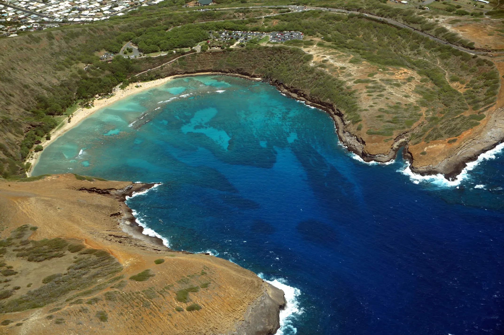
Our journey now takes us west, to the ʻEwa plain and Coral Crater Adventure Park. The air buzzes with the excited shouts of families as they strap into harnesses for the zipline, the roar of ATVs echoing from the crater floor. I join a group, the thrill of the ride undeniable as we speed across the red earth. But as the adrenaline settles, my focus shifts from the activity to the ʻāina itself. Where are we, really?
We are in the heart of Honouliuli, the largest ahupuaʻa on the island of Oʻahu, a vast and historically rich territory stretching from the Waiʻanae mountains to the sea. The park's name is a clue to its geology. This is a landscape of karstic limestone plains, the fossilized remains of an ancient coral reef. Our moʻolelo tell us that this plain was traversed by the goddess Hiʻiakaikapoliopele on her epic journey from Hawaiʻi Island to Kauaʻi. For centuries, my ancestors cultivated this land, finding ways to grow food even in the thin soil, creating gardens in the countless sinkholes that dot the landscape.
The history of this ahupuaʻa is a microcosm of the history of modern Hawaiʻi. In the late 19th century, these lands were purchased by industrialist James Campbell and transformed into a massive ranching empire, displacing traditional land use. Soon after, the Ewa Plantation Company began digging wells and planting thousands of acres of sugarcane, forever altering the hydrology of the region. During World War II, a portion of this ahupuaʻa, a gulch not far from here, became the site of the Honouliuli Internment Camp, where hundreds of Japanese American citizens and residents were unjustly imprisoned.
The crater that now serves as an adventure park is not a natural volcanic feature. It is a man-made scar on the land, a massive quarry excavated during World War II to provide coral rock for the construction of the military's Barber's Point Air Station. The park's own story acknowledges this, framing its existence as an effort to "heal this scar and bring new life" to an abandoned industrial site.
Coral Crater offers a powerful lesson in the layered history of the ʻāina. This land has gone through distinct phases: from sustenance under the ahupuaʻa system, to extraction for military purposes, and now to commercialization through recreation.
Coral Crater, then, offers a powerful, tangible lesson in the layered history of the ʻāina. This land has gone through distinct phases: from a place of sustenance under the ahupuaʻa system, to a site of extraction for military and industrial purposes, and now to a center for commodification through commercial recreation. The ATV tour becomes an ironic but potent vehicle for exploring this complex history. It is encouraging to see the park's efforts at stewardship—planting native "canoe plants" like kō (sugarcane) and ʻulu (breadfruit), and using recycled materials. These actions represent a modern attempt to find pono, or balance, on a piece of land that has been so heavily impacted by the forces of history. It reminds us that even on scarred land, the work of healing and reconnection is possible.
Continue the Journey
Discover the living arts of our kūpuna - hula, kapa making, and traditional healing practices.
📖 Cultural Guide Series
Aloha ʻāina, ʻohana, kapu
Current section
Hula, kapa & healing
Part IV: SovereigntyCultural resilience today
🏞️ Ahupuaʻa Facts
- Design: Mountain to sea
- Purpose: Self-sufficiency
- Governance: Sustainable management
- Trade: Resource sharing
📚 Key Terms
Toward the mountains, inland
Toward the ocean, seaward
Sacred forest realm of the gods
Traditional Hawaiian fishponds
🌱 Modern Relevance
- Watershed management
- Sustainable agriculture
- Community resource sharing
- Conservation planning
📧 Land & Culture
Learn how ancient wisdom applies to modern sustainability challenges.